

Construction Site Visual Intelligence: 7 Ways Aerial Monitoring Saves You Time and Money (That You're Not Using Yet)
Here's a number that'll make your CFO sit up straight: most construction clients see between 55-92% in time and cost savings in their first year using drones for mapping and surveying versus traditional methods.
Let that sink in for a second. We're not talking about marginal improvements, we're talking about slashing nearly half (or more) of your surveying and monitoring costs while getting better data faster. Yet many construction teams in Northern Virginia still haven't fully integrated aerial monitoring into their operations.
If you're still relying on ground crews with rovers and theodolites for every site check, or sending someone up a ladder with a clipboard to document progress, you're leaving serious money on the table. Here are seven specific ways construction progress monitoring with drones saves you time and money, starting today.
1. Catch Problems Early (Before They Cost You Six Figures)
Ever had that sinking feeling when you realize a grading error three weeks ago is now buried under a foundation? Yeah, we've all been there.
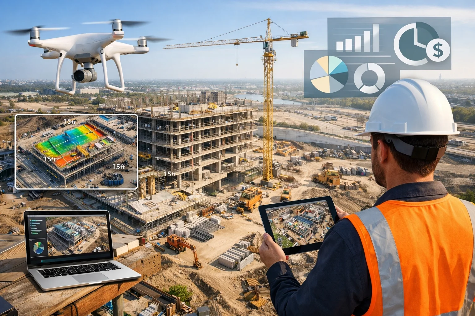
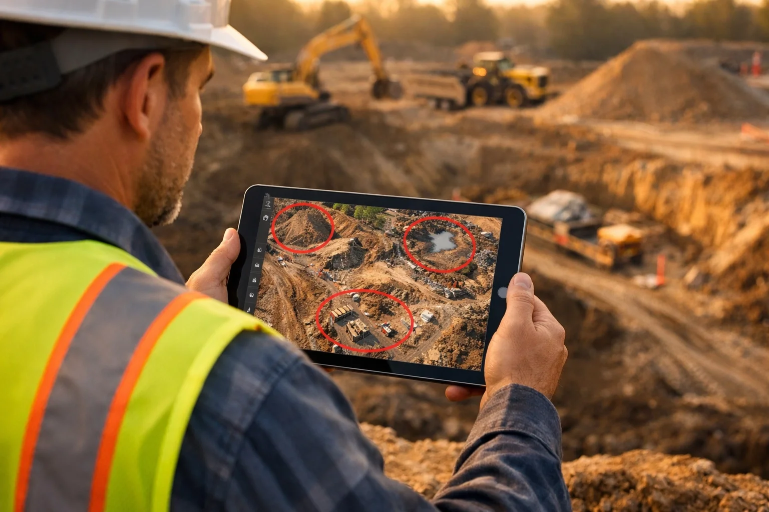
Real-time aerial construction reporting lets project managers spot issues before they become expensive nightmares. Drones capture updated views of your entire site in minutes, not days, so you can track progress and catch errors while there's still time to fix them cheaply.
Here's the kicker: industry surveys show that rework caused by inaccurate or outdated site data can account for up to 30% of total construction expenses. That's massive. Early-stage drone inspections help you identify grading issues, drainage conflicts, and coordination problems before heavy equipment mobilizes and crews get too far down the wrong path.
One weekly aerial survey can save you from a month of backtracking. Do the math on that ROI.
2. Accuracy That Settles Disputes (And Keeps Your Budget Intact)
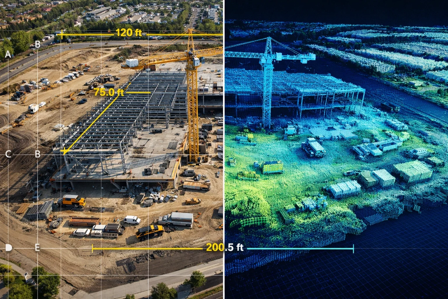
Ground surveys are great, but they're also limited to wherever your surveyor can physically walk. Drones? They capture everything, high-resolution imagery, video, and LiDAR sensor data that delivers centimeter-level accuracy across your entire site, including those hard-to-reach areas.
This precision translates into:
More accurate earthwork volume calculations
Clearer verification of cut-and-fill progress
Reduced disputes with subcontractors and stakeholders
Better bid accuracy for future projects
When your volumetric calculations are tight, you avoid the budget creep that comes from "oops, we needed way more fill than we thought." You also have hard data when a subcontractor claims they moved more dirt than they actually did. Visual proof from the sky doesn't lie.
For drone services Northern Virginia contractors trust, this accuracy is what separates amateur operators from professionals who understand construction workflows.
3. Safety Improvements That Actually Lower Your Insurance Premiums
Construction remains one of the highest-risk industries in America, accounting for nearly 20% of workplace fatalities annually. Every time you send someone up scaffolding or onto a roof for an inspection, you're rolling the dice.
Drones eliminate that risk entirely. No more workers climbing ladders, no more scaffolding setup and teardown, no more sending people into potentially hazardous areas to document conditions.
Companies that have integrated drone inspections report a 55% increase in safety standards directly related to drone usage. That's not just good ethics: it's good business. Fewer accidents mean:
Lower workers' comp claims
Reduced insurance premiums
No project delays from safety incidents
Better company reputation and morale
Plus, you're saving all the time and equipment costs associated with setting up scaffolding or lifts just to take a few photos of a roof or upper-level structural element.
4. Remote Monitoring That Multiplies Your PM's Effectiveness
Your project manager can't be everywhere at once. But a drone can be.
Remote aerial monitoring means stakeholders, owners, and PMs can track work progress from anywhere: the office, home, or another job site entirely. Instead of driving out for every inspection, you get regular aerial updates delivered digitally, complete with time-stamped imagery and geospatial data.
This shift doesn't just save fuel costs. It fundamentally changes how efficiently you can manage multiple projects. Your senior PM can oversee five sites instead of three because they're not burning half their day in the truck. AI-enabled drones and automated flight paths mean you can even schedule regular surveys without constantly dispatching personnel.
Better resource allocation throughout the project lifecycle means your best people focus on problem-solving and coordination, not just documentation.
5. Documentation That Wins Disputes and Streamlines Pay Apps
When was the last time someone questioned whether work was actually completed as claimed? Or you had to dig through photos trying to remember what the site looked like three months ago?
Drone data creates a historical, empirical record of your entire project timeline. Every flight stores high-resolution imagery that can answer questions about:
Original site conditions before you broke ground
Progress at any given date
Who was responsible for what when conflicts arise
Verification for payment applications
Visual proof from drone flights strengthens your pay apps and compliance documentation. Instead of back-and-forth with owners about whether certain work was completed, you show them a time-stamped orthomosaic that leaves no room for interpretation. This speeds up payment cycles and reduces administrative headaches.
When disputes do arise, your comprehensive aerial record becomes invaluable evidence. It's much harder to argue about facts when there's a 4K video showing exactly what happened.
6. Thermal and Environmental Monitoring Before Small Problems Become Big Ones
Standard visual inspection is great, but sometimes the problem is invisible: until it's not.
Drones equipped with thermal imaging detect issues that your eyes can't see:
Insulation problems before they impact HVAC performance
Moisture intrusion before it causes structural damage
Electrical faults before they become fire hazards
Heat loss that's bleeding your building's energy efficiency
This isn't just about catching problems. It's about proactive maintenance that saves massive money down the road. Finding a roof leak with thermal imaging before water damages interior finishes? That's avoiding tens of thousands in remediation.
Drones can also monitor environmental hazards like erosion, drainage issues, or unstable soil conditions. Implementing mitigation strategies early: when it's still cheap: beats emergency responses after a landslide or flooding event.
7. Material and Equipment Tracking That Stops Shrinkage
Construction sites are chaotic. Materials get moved around, equipment gets borrowed for "just a minute," and suddenly you're short on inventory but can't figure out why.
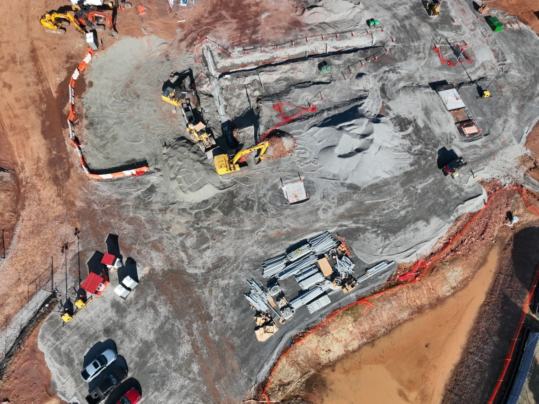
Regular aerial surveys give you a bird's-eye view of where everything actually is. You can track:
Location and quantity of materials across your site
Equipment positioning and utilization
Stockpile volumes for aggregates and soil
Changes that might indicate theft or misplacement
Improved visibility means informed decision-making about resource allocation. You know when to reorder materials, when equipment is sitting idle and could be deployed elsewhere, and when something doesn't add up.
In the US, construction site theft drives an estimated annual loss of up to $1 billion, and the recovery rate for stolen equipment is alarmingly low—below 7%. That’s exactly why better asset tracking and tighter site visibility isn’t “nice to have”… it’s a direct hit to shrinkage.
The Bottom Line: Visual Intelligence Is Your Competitive Edge
At Blue Nose Aerial Imaging of Northern Virginia, we've seen firsthand how construction teams transform their operations once they integrate aerial monitoring into their standard workflows. The 55-92% savings aren't hype: they're the result of better data, faster decisions, and catching problems while they're still cheap to fix.
The question isn't whether aerial construction reporting will become standard in the industry. It already is. The question is whether you're going to lead the change or play catch-up while your competitors work more efficiently.
Ready to see what drone-powered visual intelligence can do for your next project? Let's talk.