
aerial solutions for your mission
We deliver survey-grade data, reliable progress tracking, and high-resolution inspections tailored to your project’s exact requirements.
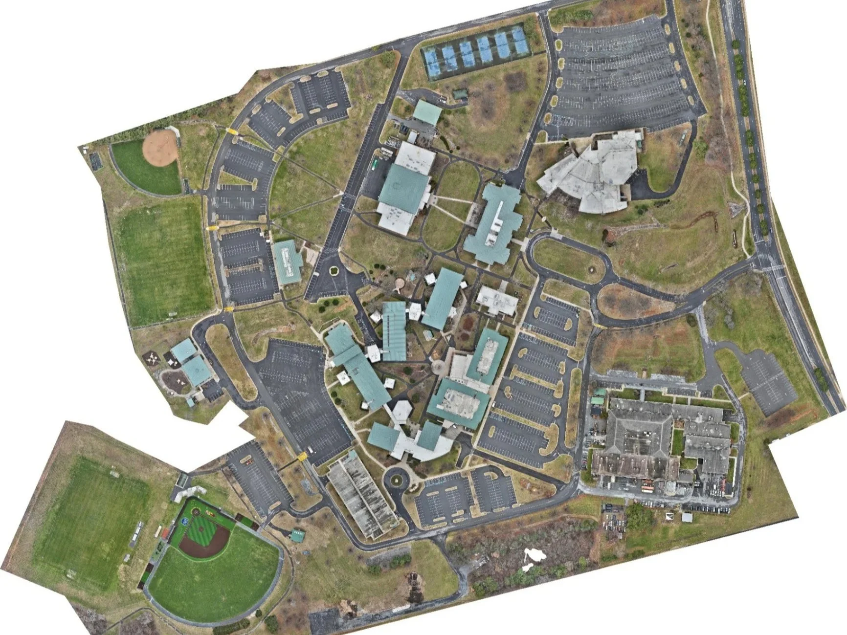
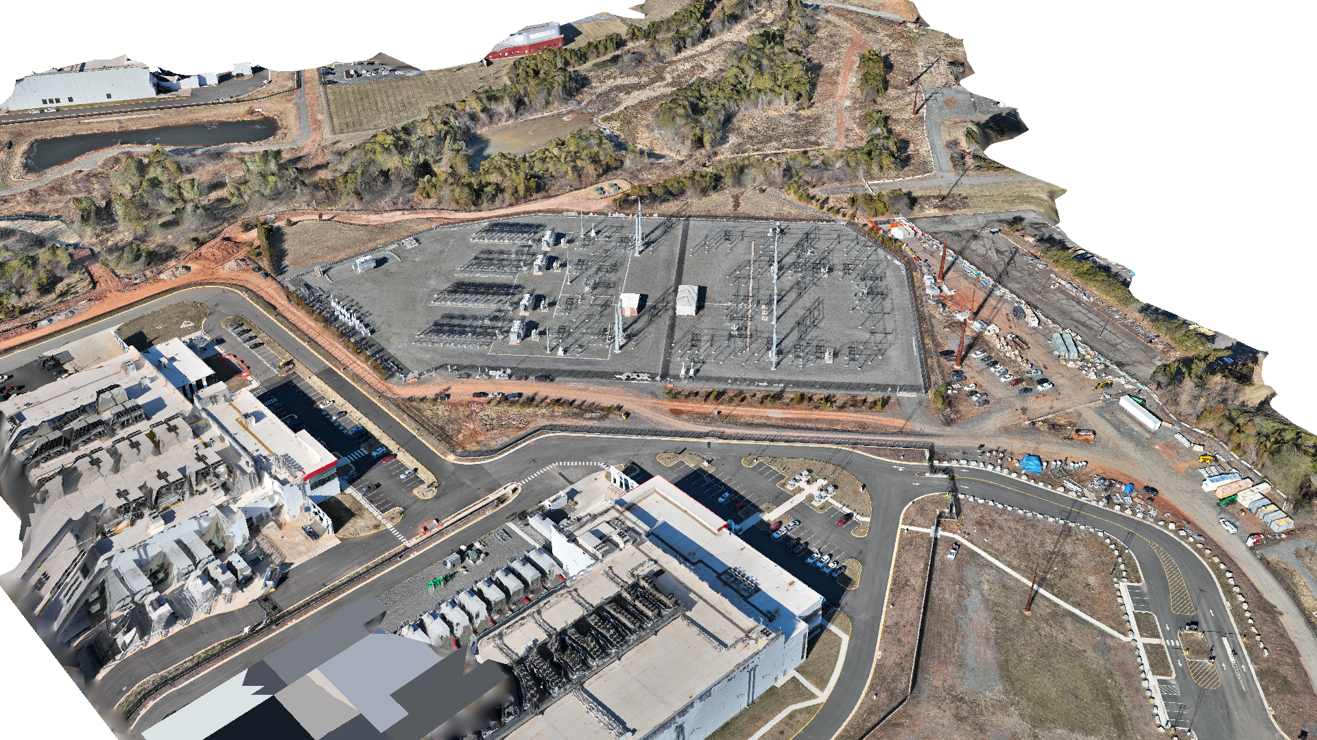
Mapping, 3D Modeling & Topography
Get survey-grade site data delivered fast. We provide the precision necessary for volumetric calculations, cut/fill analysis, and site planning.
The Deliverables:
RTK-corrected orthomosaics (GeoTIFF, JPG)
Digital Surface Models & 3D meshes (OBJ, DXF)
Volumetric calculations with annotated PDF reports
Ground Sample Distance as low as <1 cm/pixel.
Progress Tracking & Executive Reporting
Keep stakeholders aligned and reduce friction with reliable, repeatable aerial documentation. Delivered weekly or biweekly.
The Deliverables:
Timestamped photo sets from 8 cardinal directions
90-second branded site flyover video
PDF brief with compass, notes, and callouts
Executive-ready formatting customized to your brand
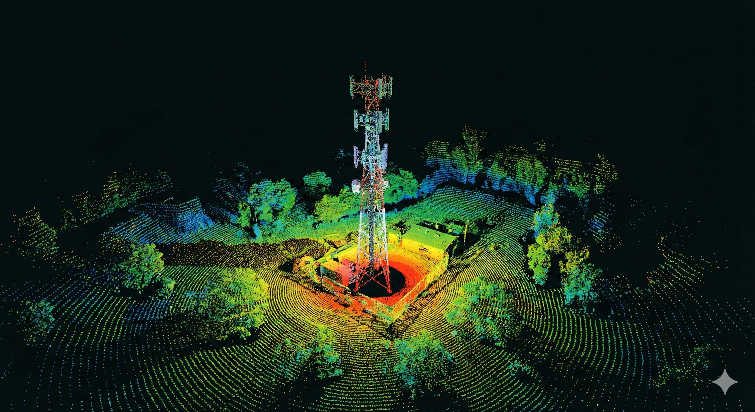
Infrastructure & Utility Inspection
Safe, high-resolution documentation for complex assets. We help teams identify liabilities and plan maintenance without putting personnel in harm's way.
The Deliverables:
High-megapixel imagery of facades and exterior cladding
Detailed commercial rooftop and equipment imaging
Tower, bridge, and parking deck inspections