

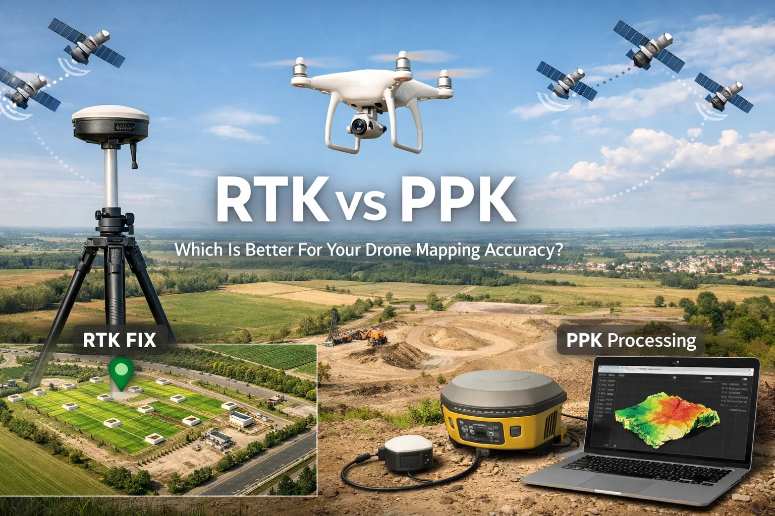
RTK vs PPK: Which Is Better For Your Drone Mapping Accuracy?
You’ve heard the buzzwords: RTK, PPK, survey-grade accuracy, and centimeter-level precision. But when you’re standing on a busy construction site in Ashburn or overlooking a utility corridor in Fairfax, which one actually matters to your bottom line?
At Blue Nose Aerial Imaging of Northern Virginia, we don’t just fly drones; we deliver Precision Aerial Intelligence. That means understanding the nuts and bolts of how spatial data is captured. If your maps are off by a foot, your volume measurements are wrong, your utility overlays are useless, and your "digital twin" is more like a distant cousin.
What is the first shield of protection against bad data? Choosing the right correction method. Today, we’re breaking down the heavyweight fight: RTK (Real-Time Kinematic) vs. PPK (Post-Processed Kinematic). We’ll look at how they work, where they fail, and why we use a mix of both to ensure your project stays on track.
The Foundation: Why Standard GPS Isn't Enough
Before we dive into the vs., let's talk about why we need these systems at all. Your phone’s GPS is great for finding a Starbucks, but it’s usually only accurate to about 10–15 feet. In the world of construction and engineering, a 15-foot error is a catastrophe.
To get to that "survey-grade" gold standard: where we're talking about 1–3 centimeters of horizontal accuracy: we need more than just satellites. We need a way to correct the atmospheric interference and timing errors that mess with GPS signals. That’s where RTK and PPK come in. They both provide the same end goal: high-precision location data for every photo the drone takes.
What is RTK (Real-Time Kinematic)?
Think of RTK as a live conversation. While the drone is in the air, it is constantly talking to a base station on the ground (or a network of stations via the internet).
How it Works
The base station stays in a fixed, known position. It calculates the errors in the satellite signals and beams a correction to the drone in real-time via a radio link or a cellular connection. The drone then attaches these corrected coordinates to the metadata of every photo it snaps.
The Pros of RTK
Instant Gratification: Because the corrections happen live, the data is "ready to go" the moment the drone lands.
Precise Flight Paths: Since the drone knows exactly where it is in real-time, it can fly extremely precise grids, which is vital for high-resolution mapping.
Streamlined Workflow: It saves time in the office because the heavy lifting of positioning is done in the air.
The Challenges
RTK is a "tethered" system. If the drone loses its connection to the base station or the cell tower: even for a few seconds: the accuracy drops. In Northern Virginia, where we deal with "urban canyons" in Tysons or heavy tree cover in Loudoun County, signal dropouts are a real threat.
That kind of survey-grade accuracy is what turns a pretty map into construction site visual intelligence—the stuff you can actually use for construction progress monitoring and weekly aerial construction reporting without second-guessing measurements.
What is PPK (Post-Processed Kinematic)?
If RTK is a live phone call, PPK is like recording a voice memo and editing it later.
How it Works
During the flight, the drone doesn't worry about receiving live corrections. Instead, it just records all the raw satellite data it sees. Simultaneously, a base station on the ground records its own raw satellite data. Once the flight is over, we take the data from the drone and the data from the base station and "marry" them in specialized software.
The Pros of PPK
Reliability: You don't have to worry about signal dropouts. Since the processing happens after the flight, a temporary loss of cellular connection doesn't ruin the data.
Flexibility: It’s ideal for remote sites or areas with poor infrastructure where maintaining a constant data link is impossible.
Accuracy Consistency: Many surveyors argue that PPK is actually more robust because the software can look at the entire flight’s data as a whole, rather than processing it second-by-second in the air.
The Challenges
The main downside? It takes more work. There is an extra step in the office to process the data before we can begin the actual mapping. However, for many of our high-stakes projects, that extra 15 minutes of processing is a small price to pay for 100% data integrity.

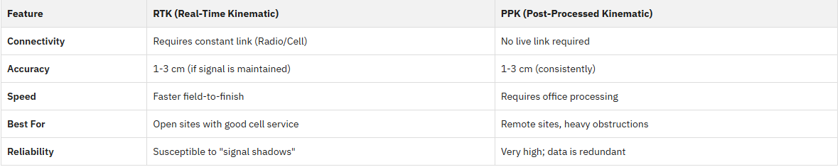
RTK vs. PPK: The Head-to-Head Comparison
So, which one wins? Here’s a quick breakdown of how they stack up in the real world:
Why the "S.I.T.E" Method Matters
At Blue Nose Aerial Imaging, we don't just pick a technology because it sounds cool. We follow our proprietary S.I.T.E Method to ensure we're delivering the best results for your specific project.
Scope: We look at your project location. Are we near Dulles Airport with high interference? Is it a remote utility line? We decide whether RTK or PPK (or a combination) is the best fit.
Inspect: We deploy our fleet of high-end drones. Whether we're using RTK-corrected maps or logging data for PPK, our FAA-licensed pilots ensure the capture is flawless.
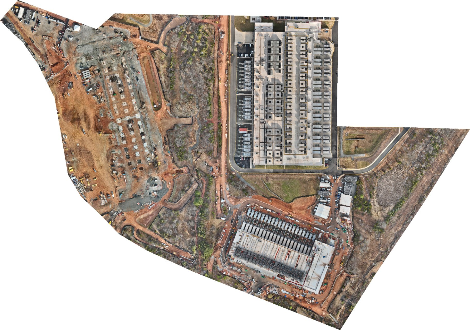
Track: This is where the magic happens. We take that raw data and turn it into actionable insights. Whether we're calculating stockpiles, tracking foundations, or building out a full reality capture timeline, the precision of our RTK/PPK workflow ensures the numbers are right every time. That’s how you get repeatable construction progress monitoring and clean aerial construction reporting that stakeholders can trust.
Export: We deliver the final product (RTK-corrected orthomosaics, 3D models, point clouds, and more) in formats that drop straight into the tools you already use—like Procore, DroneDeploy, Bluebeam, and CAD—or even something as simple as organized deliverables in Google Drive. No new logins, no “please learn our platform,” no confusing handoffs—just clean deliverables that fit your existing workflow so your team can keep moving.
Same idea on the utility side, too—when you need drone utility inspection services like aerial power line inspection or broader utility infrastructure aerial imaging, accuracy and repeatability are everything.
Which One Is Better For Your Mid-atlantic Site?
In the DMV area, we have a unique set of challenges. We have some of the most congested airspace in the country and a mix of hyper-urban and rural landscapes.
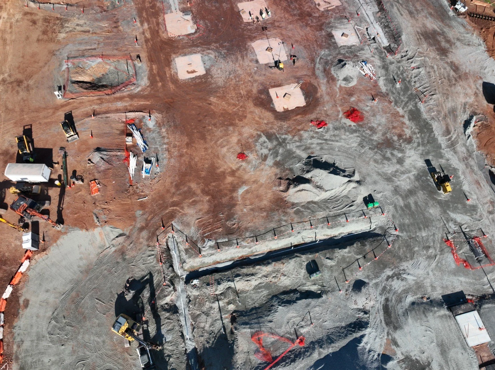
If you are managing a massive data center build in Ashburn, RTK is often the way to go. The terrain is usually flat, the cell service is great (it's the "Data Center Capital of the World," after all!), and you need those progress updates fast. Using RTK-corrected maps allows us to give you a site overview that’s ready for a stakeholder meeting by the time we get back to the office—and ready to drop into Procore/DroneDeploy for day-to-day construction progress monitoring and aerial construction reporting.
However, if we are mapping a new utility corridor through the rolling hills of Loudoun or a wooded area in Prince William County, we lean heavily on PPK. The risk of losing a signal behind a hill or a dense stand of trees is too high. By using PPK, we guarantee that every single photo has survey-grade coordinates, regardless of what the cell towers are doing. That reliability is a big deal for drone utility inspection services—especially aerial power line inspection work—because it helps keep your utility infrastructure aerial imaging consistent from one flight to the next.
The Secret Ingredient: Ground Control Points (GCPs)
Here’s a little "insider" secret: even with the best RTK or PPK system, we still use Ground Control Points (GCPs). Think of GCPs as physical anchors. We place targets on the ground and measure them with a traditional GPS rover.
By combining RTK/PPK with a few strategically placed GCPs, we create a "double-check" system. It’s how we ensure that our Precision Aerial Intelligence isn't just a marketing slogan: it's a mathematical fact. This level of redundancy is why Blue Nose is trusted by top construction and utility managers across Virginia.
Making the Right Choice for Your Project
At the end of the day, you shouldn't have to worry about the technical differences between RTK and PPK. That’s our job. When you partner with us, we handle the technical heavy lifting so you can focus on making decisions based on accurate data.
Here’s the key takeaway: you don’t have to change your workflow to get survey-grade results. We deliver RTK-corrected maps, 3D models, and point clouds in the file types and integrations that plug into what you’re already running—Procore, DroneDeploy, Bluebeam, CAD/GIS, Google Drive, and your existing reporting process. That means your orthomosaics and models become usable construction site visual intelligence right away for construction progress monitoring, aerial construction reporting, and reality capture documentation—without adopting a new or unfamiliar platform.
Are you looking for survey-grade accuracy on your next project? Whether you need a 3D model of a new development or a high-resolution orthomosaic for site planning, we’ve got the tech and the expertise to get it done right.
Ready to see the difference that precision makes? Let’s get to work!