services
aerial solutions for your mission
We deliver survey-grade data, reliable progress tracking, and high-resolution inspections tailored to your project’s exact requirements.
All deliverables are provided in your preferred format and platform (CAD, BIM, etc.) to seamlessly integrate into your existing workflow without requiring new tools or software.
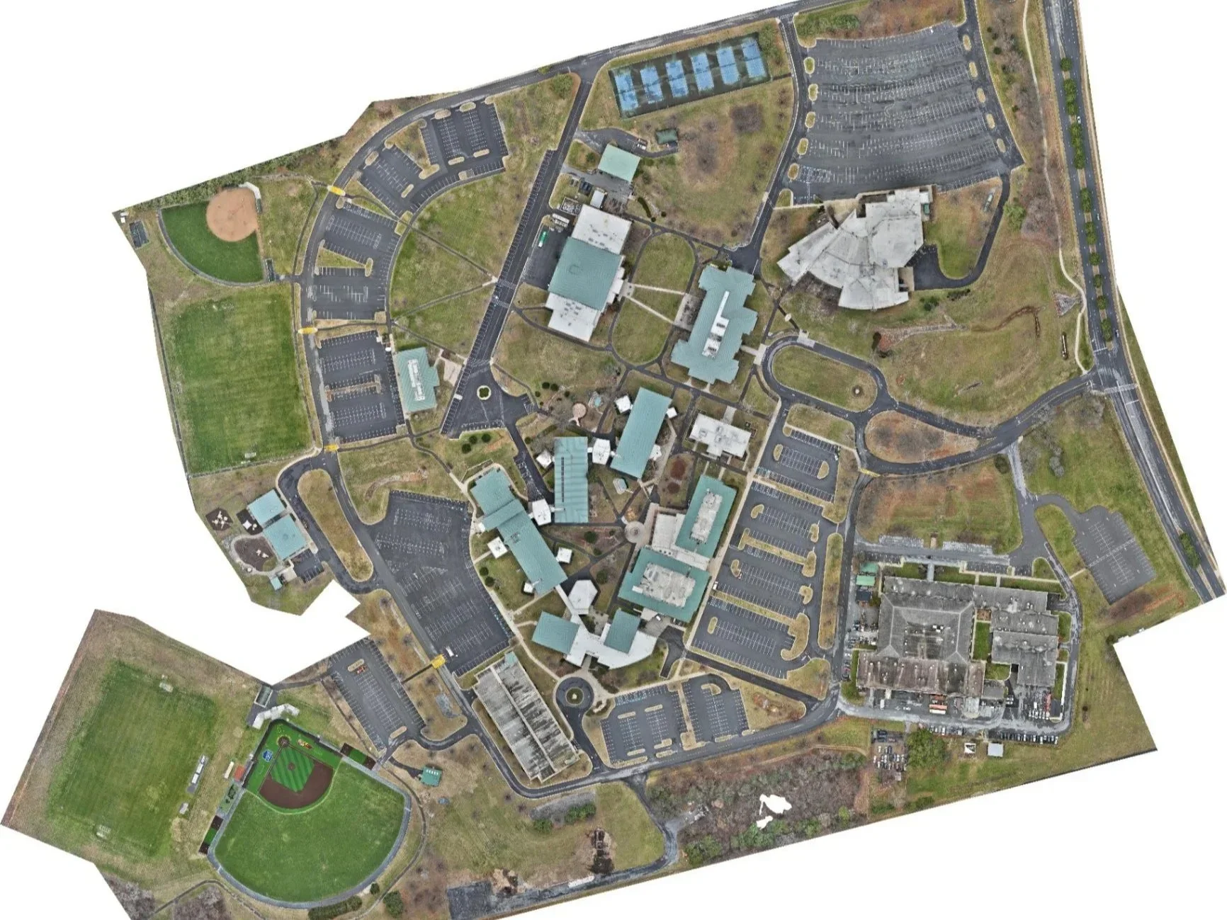
Mapping, 3D Modeling & Topography
Get survey-grade site data delivered in 24–72 hours. We provide the precision necessary for volumetric calculations, cut/fill analysis (how much earth needs to move), and site planning.
The Deliverables:
RTK (GPS-grade accuracy)-corrected orthomosaics (GeoTIFF, JPG)
Digital Surface Models & 3D meshes (OBJ, DXF)
Volumetric calculations with annotated PDF reports
Ground Sample Distance (GSD — how sharp the image is) as low as <1 cm/pixel.
Progress Tracking & Executive Reporting
Keep stakeholders aligned and reduce friction with reliable, repeatable aerial documentation. Delivered weekly or biweekly.
The Deliverables:
Timestamped photo sets from 8 cardinal directions
90-second branded site flyover video
PDF brief with compass, notes, and callouts
Executive-ready formatting customized to your brand

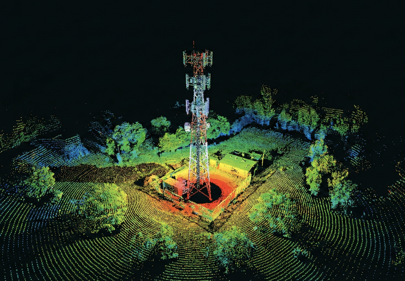
Infrastructure & Utility Inspection
Safe, high-resolution documentation for complex assets. We help teams identify liabilities and plan maintenance without putting personnel in harm's way.
The Deliverables:
High-megapixel imagery of facades and exterior cladding
Detailed commercial rooftop and equipment imaging
Tower, bridge, and parking deck inspections